TIC Jezersko
+386 (0)51 219 282
tic@jezersko.si
Home About Jezersko Contact Other Services News and events Nature Culture Accommodation Activities Local cuisine Inns and Restaurants Traditional events Packages Local offer Multimedia

Useful

The Karavanke Hiking Trail is a long-distance trail that runs along the slopes of the Karavanke and its valleys boasting with wonderful views of this rugged mountain range. The trail includes seven daily hiking stages ranging from 14 to 28 km in length. The total length of the route is 144 kilometres.

The long-distance Karavanke trail brings together places and people that are a part of the Karavanke mountain range in a unique hiking experience. The trail runs through easily accessible mountain areas, where we explore the surroundings and experience natural features. On a hiking tour, you get to meet locals who live with the area, learn about old customs, discover mountain plateaus and experience the valley’s everyday richness. On the sunny and grassy slopes of the mountains one comes across wonderful views of the Sava valley, the Julian Alps and the entire Gorenjska. This is a path of intertwined sensations, wonderful views, a simple hiking experience and a taste of life under the Karavanke.


Stage 1: Zgornje Jezersko – Preddvor

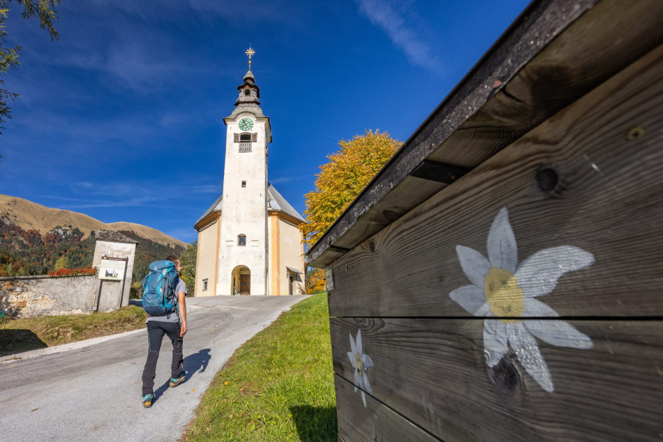
The introductory stage of the Karavanke Trail starts at Zgornje Jezersko, which is also the starting point for hiking trails to the Kamnik-Savinja Alps. The path takes us past the old church of st. Ožbolt, where we have a view of the Kamnik-Savinja Alps and, further on, leads us along the right bank of the Kokra river and later under the valleys and eastern slopes of Mt. Storžič to Bašeljsko sedlo (mountain pass). We descend from the pass via Hudičev boršt and walk along scenic routes to Preddvor.

A more demanding hiking stage with a touch of real mountains and wonderful views of the Gorenjska region and Kamnik-Savinja Alps.

Length: 26,1 km

More about Stage 1


Stage 2: Preddvor – Kranj

A pleasant and easier hiking stage that connects villages below Storžič with the capital of Gorenjska. The route takes us from Preddvor past the Brdo estate through smaller suburban settlements to the deep Kokra canyon. There we reach the old town of Kranj, which is "sprinkled” with local tourist attractions.

An easier stage with getting to know the settlements and authentic contact with the hustle and bustle of the capital of Gorenjska.

Length: 13,4 km

More about Stage 2


Stage 3: Kranj – Tržič

A dynamic stage that takes place away from the city’s hustle and bustle and takes a hiker into true mountain nature. From Kranj we go to the Brdo estate, continues past Čukova jama and the Račnik pond into the heart of the Udin boršt forest. Here we can enjoy riches of the mighty nature. From the wooded area, we start ascending past Golnik and on to a plain under Kriška gora. This is followed by a pleasant descent into the Tržič valley, where we are greeted by the rich industrial tradition of the town, strongly connected with Karavanke.

The longest stage with a touch of rugged terrain and natural diversity.

Length: 28,7 km

More about Stage 3


Stage 4: Tržič – Begunje na Gorenjskem

A hiking stage that initially leads us under the slopes of Dobrča to the village of Peračica and past the prominent pilgrimage spot Brezje with the Basilica of St. Mary Help of Christians. We continue by descending to the Peračica area, where we are touched by charming river waterfalls. We continue past steep mountain slopes and quickly find ourselves in Begunje na Gorenjskem. A small place with an exceptional tradition and home to one of Avsenik’s best-known tunes – Na Golici.

An easier stage that pampers us with the variety and diversity of the valley.

Length: 16,7 km

More about Stage 4


Stage 5: Begunje na Gorenjskem – Dom Pristava

A true hiking stage awaits us in Begunje, which winds through the most beautiful areas of the Karavanke. At first, the route takes us along the scenic route past St. Peter and Smokuški vrh, from where we descend into the Završnica valley. From there we hike to the most beautiful and more picturesque mountain pastures below Mt. Stol, the highest mountain of Karavanke, and Vajnež. The route leads us past Valvasorjev dom via Potoška and Olipova planina to Stamare mountain pasture (planina), from where we descend to the former mining area in Javorniški Rovt.

A more demanding and varied hiking stage, full of mountains with wonderful views of the Gorenjska and Julian Alps.

Length: 20,7 km

More about Stage 5


Stage 6: Dom Pristava – Mojstrana

The path leads us from Javorniški Rovt to the scenic slopes of Španov vrh, which are most enchanting in May, when the slopes are full of white daffodils. Next, we descend to Planina pod Golico, which offers the diversity and fullness of life under the mountains. We continue in the direction of the Plavški rovt and along the rugged area below Hruški vrh, where we enjoy the view of the Julian Alps. This is followed by a descent to Dovje and further to the right side of the river Sava Dolinka, and all the way to Mojstrana. The stage ends just before the Vrata glacial valley, which leads to the base of the famous Triglav’s Norht Face.

A pleasant stage for hikers, which leads us through the slopes below Golica to the "gate” of the Julian Alps.

Length: 20 km

More about Stage 6


Stage 7: Mojstrana – Kranjska Gora

In Mojstrana we join the long-distance Juliana Trail, running from Mojstrana to Kranjska Gora. A pleasant flat section soon leads us to the Gozd Martuljk village, where we ascend to the lower slopes of the Karavanke mountains and, from a vantage point, admire the Martuljek mountain group – the mightiest part of the Julian Alps. We continue with a gentle descent in the direction of Kranjska Gora.

An easy hiking stage that runs along the river Sava Dolinka and rewards us with views of the sharp mountain peaks of the Julian Alps.

Length: 16,8 km

More about Stage 7

Copyright 2024, Production MMstudio